What are riparian areas?
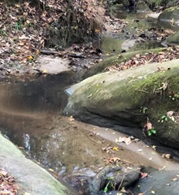
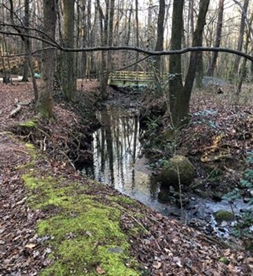
Riparian areas are lands that occur along watercourses and water bodies. Typical examples include flood plains and streambanks. They are distinctly different from surrounding lands because of unique soil and vegetation characteristics that are strongly influenced by the presence of water.
General indicators of riparian areas include:
Vegetation
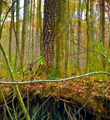
The kinds and amounts of vegetation differ from adjacent upland vegetation because more water is supplied to plants from the associated watercourse or water body.
Soil
Soil in natural riparian areas consists of stratified sediments of varying textures that are subject to intermittent flooding or fluctuating water tables that may reach the surface. The duration of soil wetness depends on the water levels of the adjacent water body.
Water
Riparian areas are directly influenced by water from a watercourse or water body. They occur along natural watercourses or next to natural lakes and constructed water bodies such as ditches, canals, ponds, and reservoirs.
In the western United States, riparian areas comprise less than 1 percent of the land area, but they are among the most productive and valuable natural resources. There is a significant difference between the water-rich riparian areas and the arid uplands. Riparian areas are the major providers of habitat for endangered and threatened species in the western desert areas. In the humid east, the riparian areas are more similar to the uplands. In many areas, the separation of the riparian zone from the upland is not distinct.
Values and functions of riparian areas
Because of their variation across the country, riparian areas function in different ways. In spite of their differences, all riparian areas possess some similar ecological characteristics such as energy flow, nutrient cycling, water cycling, hydrologic function, and plant and animal population. These functions give riparian areas unique values relative to the surrounding landscape. Some of the more recognizable functions and values of riparian areas are:
Hydrology
Water flow that shaped the riparian zone affects soil development and growth of vegetation.
Because riparian zones occupy low areas in the landscape, ground water is generally nearer to the surface and available for plants. The fine-textured sediments in flood plains are also able to hold large amounts of water. These two conditions promote productive and diverse plant communities.
Nutrients for plant growth in riparian ecosystems depend on sedimentation of nutrient-rich organic matter and on the dissolved nutrients in the water. Riparian zones are often nutrient-rich ecosystems.
Because flooding occurs periodically, and ground water moves through flood plain soils, the surface layers of soils are wetted and dried seasonally. The presence and movement of the surface and ground water enhance the recycling of nutrients and other chemical reactions beneficial to plant growth within the riparian zone.
The timing of flooding is important to the life cycle of many aquatics and some terrestrial species. A naturally occurring flood pulse enhances survivability of organisms within the riparian zone and promotes species diversity and biological productivity.
Base flow
Alluvial soil, which is sedimentary material deposited by flowing water, is usually deep and stores large amounts of water from rainfall and runoff. Many alluvial aquifers in the western United States are maintained by infiltration of upland runoff in the stream channel or riparian alluvial deposits. Base flow–that portion of water flowing in a stream that is due to ground water seepage into the channel–is further maintained by riparian vegetation that shades the water, keeping it cooler and slowing evaporation.
Nutrient cycling
Once nutrients enter a riparian area, they are exposed to mechanisms that may use or change them. Some nutrients, especially nitrogen, phosphorus, calcium, magnesium, and potassium, are taken up by shallow-rooted riparian vegetation. Dissolved nutrients moving with the ground water and those that are leached in the soil may be taken up by deeper-rooted riparian vegetation. Some nutrients pass through without being detained, and some that are taken up by riparian vegetation may be reintroduced into the water column when the vegetation dies and decomposes.
Energy transfer
The uniqueness of riparian areas derives from the fact that litter-fall produced within the riparian ecosystem may be transported laterally and made available to in-stream animal communities as well as those downstream from the source of organic matter production. As compared with purely aquatic or terrestrial ecosystems, riparian organic matter has the potential of supporting a diversity of food webs within both habitats.
Downstream flooding
Riparian area vegetation is a key factor in reducing downstream flooding. As floodwater flows through a vegetated area, the plants resist the flow and dissipate the energy, increasing the time available for water to inflitrate into the soil and be stored for use by plants.
Water quality
As floodwater spreads over a flood plain, water velocities are reduced, making it less likely for sediment and nutrient-rich organic materials to reenter the stream. Sediment and nutrients carried by overland flow from adjacent uplands are also intercepted by the riparian area.
Aquatic life
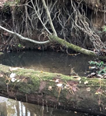
Rooting herbaceous and woody vegetation helps shape aquatic habitat and stabilizes streambanks, retards erosion, and, in places, creates overhanging banks that serve as habitat for fish. Trapping sediment before it reaches the stream helps maintain a cleaner or more sediment-free stream bottom where aquatic organisms live. These organisms are important sources of food for fish and birds.
Terrestrial life
Riparian ecosystems are extremely productive and have diverse habitat values for wildlife. This is demonstrated most visibly in the western United States, where riparian habitat comprises less than 1 percent of the total land area at some time of the year but supports most of the terrestrial wildlife. The linear nature of riparian ecosystems provides distinct corridors that are important as migration and dispersal routes and as forested connectors between habitats for wildlife.
Some riparian areas meet the criteria established for wetlands. The functions of wetland and riparian areas generally depend on configuration, soils, vegetation, hydrology, and landscape context. Even nonwetland riparian areas share many characteristics, functions, and values with wetlands; such as surface or ground water, or both, and several varieties of plant and animal communities.
Disturbances to riparian areas
Flooding the the resulting erosion and deposition are common forces that shape the riparian area. During extreme flooding, these forces can sometimes appear devastating, but in most cases, the riparian area recovers rapidly. On the other hand, changes made by people often have long-term adverse effects on riparian areas. Building dams across channels, constructing levees, and the channelization of the streams may have the most adverse impact. These modifications significantly alter the movement and storage of water that is so important to the riparian system. Water withdrawals from streams also may reduce base flow, depriving riparian areas of moisture.
People’s most common disturbance to riparian areas involves clearing vegetation and converting the area to other uses such as cropland and urban land. Excessive logging can strip the banks of vegetation. Overgrazing concentrates livestock in riparian areas for extended periods, reduces the vegetation, and tramples streambanks. Recreational development can destroy natural plant diversity and structure, lead to soil compaction and erosion, and disturb wildlife. Exotic plants that take advantage of the good growing conditions found in riparian zones often invade these areas. As these plants dominate native plants, the overall vegetative diversity decreases, resulting in less favorable habitat for most wildlife species.
The character of a riparian area is dependent upon he condition of its watershed. Most important is the relationship of watershed hydrology to the riparian area. In general, the amounts and type of vegetative ground cover, the area of the watershed, and the slope of the terrain are directly related to the percentage of water that will enter the drainage system as surface flow or as percolated water. Riparian plant composition, habitat structure, and productivity are determined by the timing, duration, and extent of flooding. Land use changes, paved-over areas, or the removal of vegetation cause water to flow quickly from a watershed and through a riparian zone. Soil moisture storage and productivity are reduced. This can lead to prolonged periods of no flow or low flow and increase frequency and duration of flooding, resulting in a drastic decline in productivity.
Multiple benefits
Riparian areas help control nonpoint source pollution by holding and using nutrients and reducing sediment.
Riparian areas are often important for the recreation and scenic values. However, because riparian areas are relatively small and occur in conjunction with watercourses, they are vulnerable to severe alteration and damages caused by people.
Riparian areas supply food, cover, and water for a large diversity of animals and serve as migration routes and stopping points between habitats for a variety of wildlife.
Trees and grasses in riparian areas stabilize streambanks and reduce floodwater velocity, resulting in reduced downstream flood peaks.
Alluvial aquifers help maintain the base flow in many rivers in humid areas because of high water tables. In drier climates, streams lose water that can help build up the water table deep beneath the stream.

